New GNSS Receiver PENTAX GX2 Series Released New models with photogrammetric surveying function and laser rangefinder The new PENTAX GX2 series is equipped with a photogrammetric surveying function and laser rangefinder!
TIアサヒ株式会社
TI Asahi Corporation (headquartered in Saitama City, Saitama Prefecture; Hidehiko Tanaka, President), a manufacturer and distributor of PENTAX measurement equipment, will start selling the new GNSS receiver "GX2 Series" in Japan on February 3, 2025.
Detailed URL: https://www.pentaxsurveying.com/support/movies/5320/

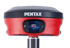
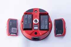
PENTAX GNSS receiver GX2 series
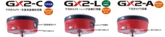
The GX2 Series lineup consists of three models to suit various applications: GX2-C, GX2-L, and GX2-A.

GX2 Series Lineup
GX2-C Downward-facing (for pile driving) camera with photogrammetric surveying function
GX2-C downward-facing camera + photogrammetric surveying function
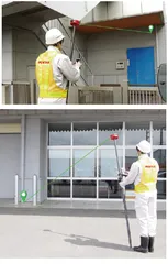
Convenient for measuring inside fences and median strip curbs that are difficult to access directly.
After taking a picture of a measurement point once and walking with the camera pointed so that the measurement point is within the shooting range, the camera automatically takes a picture and displays the number of cuts taken.
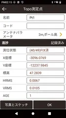
After taking a picture, align the point to be measured on the image with the cross mark, and tap the selection button to display the coordinates.
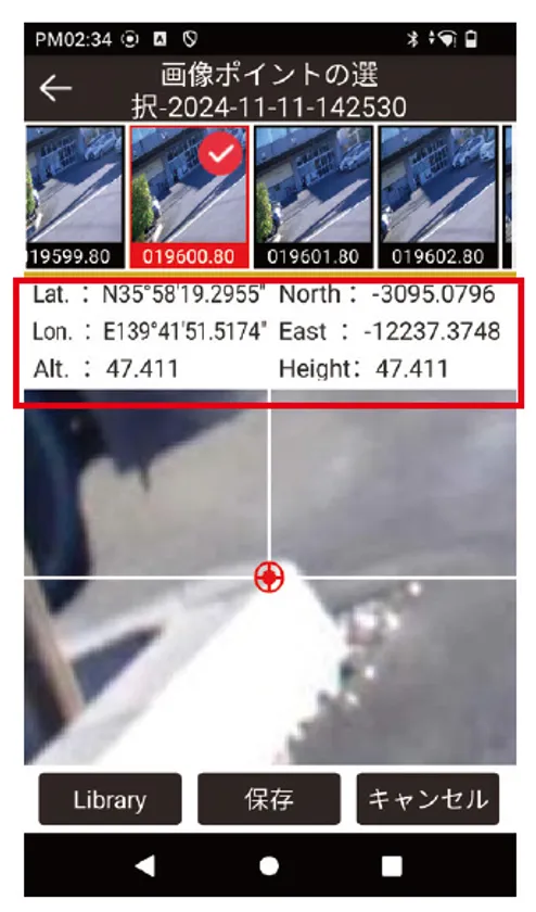
Display of coordinates for photogrammetry (in red frame)
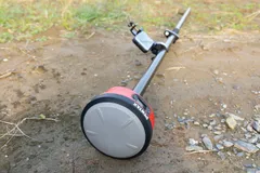
GX2-L downward facing camera (for pile driving) + laser range finder
Convenient for measuring in places that cannot be approached directly or at high elevations.
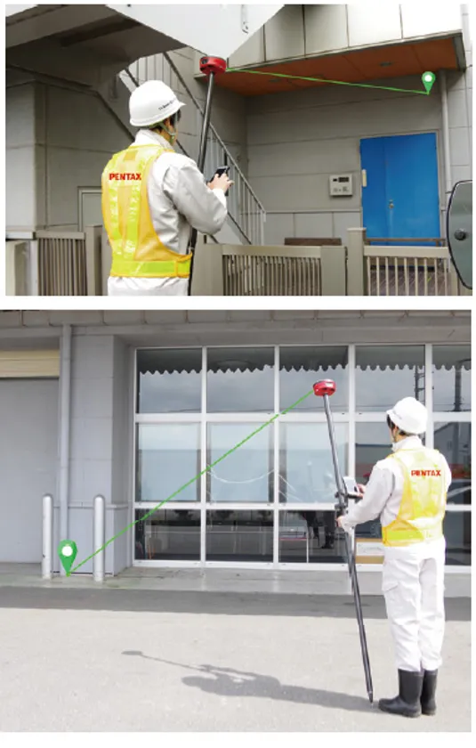
Image of the laser range finder mounted on the GX2-L
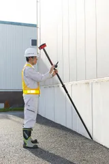
AR real-time downward-facing camera (for pile driving) mounted on 3 models of GX2-A
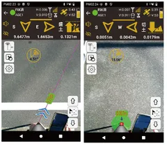
A downward-facing (staking) camera guides the user to the point with real-time images of the actual location and arrows. A red circle will be displayed when approaching the point. This helps to improve the efficiency of the surveying work.

Controller screen when using the camera for pile driving
Main Features (common to all three models)
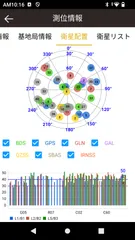
High-performance satellite receiver board (high-precision positioning module) with 1408 channels
Receives signals from GPS, GLONASS, Galileo, BeiDou, and QZSS, enabling quick, high-precision observations.

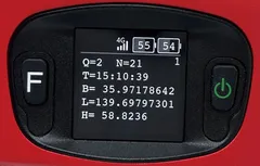
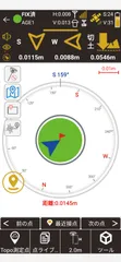
Satellite placement (controller screen)
Network RTK observation without cables
Data from a reference point or virtual reference point on the network can be acquired from a distribution server.
Easy installation and measurement in approx. 10 sec.
Non-stress of waiting time.
The average RTK initialization time is only about 10 seconds. Also, RTK remembers the previous settings and starts observation automatically.
Easy Installation
Equipped with tilt correction function
RTK corrects coordinates in real time within a range of ±60° using an inclination sensor.

Equipped with tilt correction function
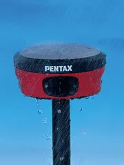
Dustproof and waterproof design P68
Safe to work even in a sudden strong rain.
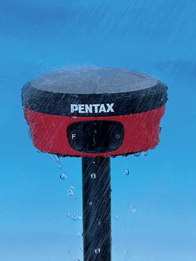
Dustproof and waterproof design P68
Excellent shock resistance
The main body is made of lightweight and sturdy magnesium alloy, which provides excellent heat dissipation and shock resistance.
It is compact, weighing only 1.03 kg including the battery.
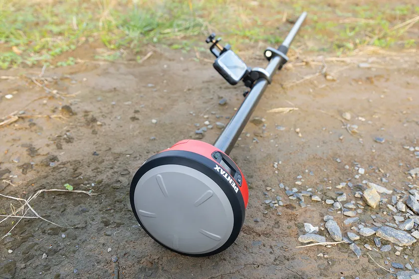
Excellent shock resistance
Continuous use time of approximately 20 hours (with 2 batteries)
Two hot-swappable batteries are standard.
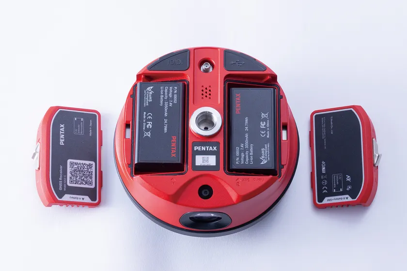
Continuous use time of approximately 20 hours (with two batteries)
Easy-to-read display
The display shows network connection status, battery level, number of satellites, and location information.
The display indicates that the GNSS receiver is receiving satellites.
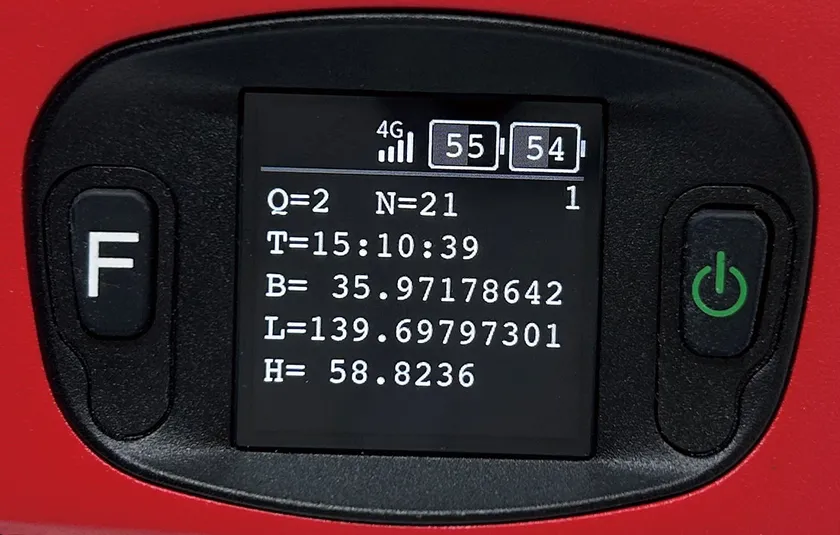
Easy-to-read display on the main unit
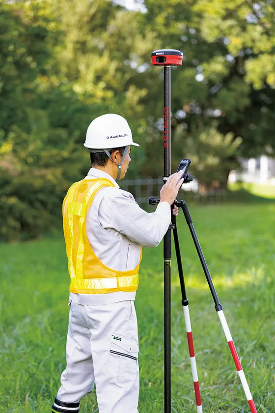
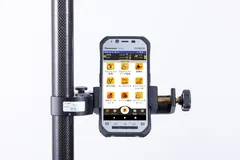
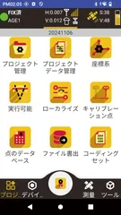
PTS application for controllers
The dedicated application PTS has a convenient photo-taking function and map photo display.
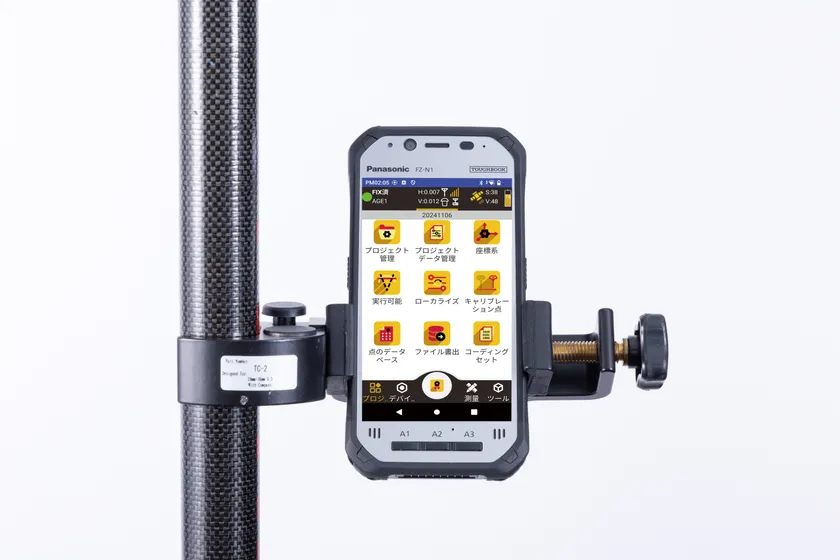
Dedicated application PTS Controller image
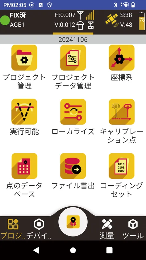
Menu screen
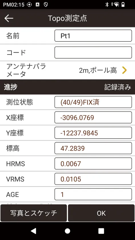
Observation
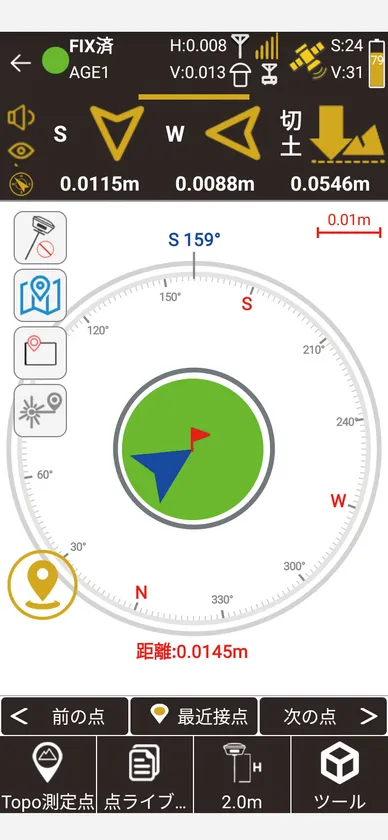
Guidance
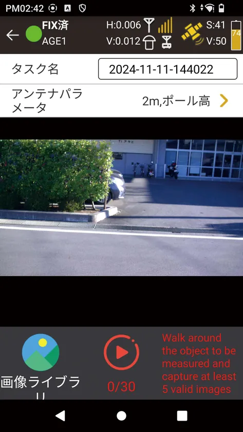
Photography function
Standard Components
GX2 main unit
Battery (BP09) x 2
Battery charger (BC05 set)
Adapter (MT02)
USB cable
Controller set
Controller holder
Warranty card
Case
GX2 series price
Open price
About TI Asahi Corporation - Manufacturing surveying instruments for almost 90 years
Ltd., which started manufacturing surveying instruments in 1933 and was given the PENTAX brand name in 1976. In 2009, we established TI ASAHI CORPORATION. Ltd. was established in 2009. The company develops, manufactures, sells, and provides after-sales service for surveying and measuring instruments. Our main products are total stations, GNSS receivers, UAV and laser surveying systems, terrestrial 3D laser scanners (TLS), and various software. PENTAX's highly reliable surveying instruments, which are highly accurate even under the harshest conditions and easy to operate, have earned the trust of customers in Japan and abroad. In recent years, PENTAX has been providing laser scanners, UAVs, and laser surveying systems, contributing to the productivity improvement and development of construction sites.
Company Profile
Name: TI Asahi Corporation
Location: 4-3-4 Ueno, Iwatsuki-ku, Saitama-shi, Saitama
Representative Director: Hidehiko Tanaka
Image


Logo Image
- Category:
- Goods