District-Level Future Population Projection Tool Reaches 1,000 Downloads in First Two Months! The tool has been downloaded more than 1,000 times in the first two months since it was released! Latest Population Projections and More!
Ministry of Land, Infrastructure, Transport and Tourism, The National Institute for Land and Infrastructure Management
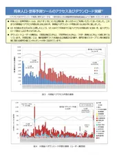
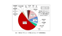
The National Institute for Land and Infrastructure Management (NILIM) of the Ministry of Land, Infrastructure, Transport and Tourism (MLIT) released an improved version of its tool for projecting future population and households by subregion in June 2024, and the number of downloads exceeded 1,000 in the two months through the end of July. The improved version of the tool is capable of the latest population projections based on the results of the 2020 Population Census, which were requested by many users.
Ministry of Land, Infrastructure, Transport and Tourism, National Institute for Land and Infrastructure Management, Urban Research Department, Urban Planning Research Office
URL: https://www.nilim.go.jp/lab/jbg/depopulation.html
Future Population and Household Projection Tool V3 download site (G-spatial Information Center)
URL: https://www.geospatial.jp/ckan/dataset/cohort-v3
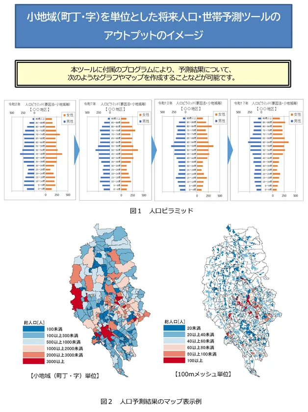
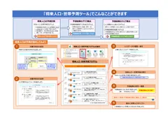
Output image of the "Future Population and Household Projection Tool by Sub-area
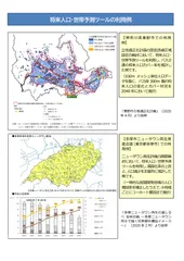
The "Tool for Projecting Future Population and Households by Subregion" was released in January 2009 as part of the National Institute of Land and Infrastructure Management (NILIM) research, and has been used by a great many people for such purposes as developing location optimization plans, urban master plans, suburban residential complex revitalization plans, and regional public transportation plans for the formation of compact cities. The tool has been used by a large number of people. This tool is also introduced as an example of a method for predicting future population by district in the "Guide to Location Optimization Planning" (Urban Planning Division, Urban Bureau, Ministry of Land, Infrastructure, Transport and Tourism, https://www.mlit.go.jp/toshi/city_plan/toshi_city_plan_tk_000035.html). The tool has been used by many users.
Many users have requested that this tool be able to handle the latest population projections based on the results of the 2020 census. In response to this, we have prepared and released an improved version (Version 3). This new version enables the latest population projections to be used in the formulation and review of various future plans.
Main features of this tool
The tool enables the future projection of population by 5-year age group and sex and the number of households* by subregion, which have been available only by municipality.
The latest future projections are based on the results of the 2020 census (version 1 corresponds to the results of the 2010 census, version 2 to the results of the 2015 census).
The system can be operated on Microsoft Excel and can be easily manipulated with pull-down menus, etc.
The database includes a national population database, eliminating the need to prepare new data.
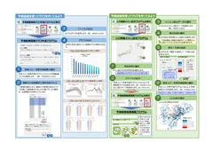
The results can be graphed to show population trends, population pyramids, and other information.
Projection results can be displayed as a map on Microsoft Excel (with a legend).
The results can also be used in a geographic information system (GIS), and can be allocated to a 100-meter mesh.
The National Institute of Population and Social Security Research (NIPSSR) has not yet released the latest data necessary for forecasting the number of households. We plan to release a version of this tool that can forecast the number of households in the future after the necessary data is released by the National Institute of Population and Social Security Research.
How to obtain this tool
After registering as a user at the G-Spatial Information Center, a portal site operated by the Council for the Promotion of Information Exchange on Social Infrastructure (https://www.geospatial.jp/), visit the website of the National Institute for Land and Infrastructure Management, Ministry of Land, Infrastructure, Transport and Tourism (https://www.geospatial.jp/ ckan/organization/nilim ). (The tool is available free of charge.)
Organization
Name of Organization: National Institute for Land and Infrastructure Management (NILIM), Ministry of Land, Infrastructure, Transport and Tourism
Representative: Takahiro Fukuda, Director-General
Location: 1 Asahi, Tsukuba, Ibaraki 305-0804, Japan
For inquiries from the general public, please contact
Urban Planning Research Office, Urban Research Department, National Institute for Land and Infrastructure Management
Urban Planning Research Department, National Institute for Land and Infrastructure Management (Ext. 4420)
Director, Urban Research Department, National Institute for Land and Infrastructure Management (Ext. 4511)
TEL: 029-864-2211 (main)
E-mail: nil-tosikei@ki.mlit.go.jp
Image

Logo Image
- Category:
- Corporate Trends